DISCOVER DERBYSHIRE
AND THE
PEAK DISTRICT
|
DISCOVER DERBYSHIRE AND THE PEAK DISTRICT |
|
CHAPEL-EN-LE-FRITH WALK THE WALK
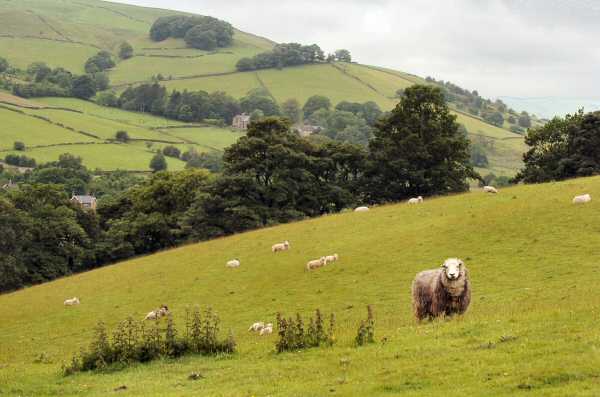
This is a delightful scenic walk, in a peaceful corner of North West Derbyshire between Chapel-en-le-Frith and Whaley Bridge.
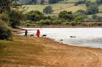
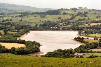
The walk starts from the Combs Reservoir car park and follows the banks of the reservoir, before going through a series of fields and along a country lane to the charming little village of Combs.
Herbert Frood was born at Combs and during his time as a boot salesman, he noticed how carters tied old boots to the wooden brake blocks on their carts to provide a more effective and longer lasting braking system. After carrying out experiments of his own he took over a mill in Chapel-en-le-Frith around 1900 and started to manufacture brake shoes. Eventually a public company was formed under the name of Ferodo, which became the largest single unit manufacturing friction brake linings in the world.
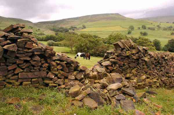
After leaving Combs the walk climbs up the hillside near to Bankhall Farm, before descending slowly towards the railway line below. This section of the route provides fine views over Combs Reservoir towards Manchester and in the other direction, the cliffs of Combs Edge.
The final part of the walk crosses Chapel-en-le-Frith Golf Course, before returning to the starting point along the reservoir embankment.
WALK DETAILS
Length: 3.5 miles.
Start/finish:
Combs Reservoir Car Park.
The car
park is about a quarter of a mile along the narrow road below the dam.
Please do not use Combs Sailing Club car park as you may be locked in. Location: Off the B5470 Manchester road, one mile from the centre of Chapel-en-le-Frith. Watch out for the partly hidden sharp left turn for the reservoir, just before the sign for Tunstead Milton.
Terrain: One short steep climb after leaving Combs, but mainly easy walking unless wet and muddy.
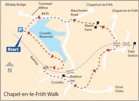
ROUTE
1. Leave Combs Reservoir Car Park and walk along the western bank of the reservoir.
2. Shortly after passing the end of the reservoir, the path continues close to the field boundary on the right, through two small fields.
3. In the third field, a footbridge on the right is crossed, and in the next field aim diagonally left to a stile in the far corner.
4. Turn left under a railway bridge and cross a narrow field to a lane, turn left down the lane and follow it round to Combs.
5. Walk through the village past the Beehive Inn on the left, and continue straight on, where the roads fork keep to the left signed for ‘Dove Holes.’
6. Take the second footpath sign on the left, just after passing Millway Cottage. The sign is set back from the road in an open space and reads ‘Chapel-en-le-Frith Station.’
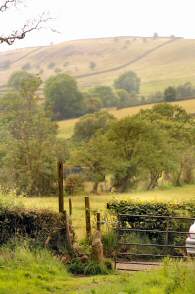
7. After walking up an enclosed track for about 100 yards, continue ahead with a field wall on your right up a steeply rising field.
8. Go through a gap in the wall in the top right hand corner of the field and carry straight on up the next field through another gap, in the centre of the wall at the top of the field.
9. Cross the next field to go over a wall stile. Then follow an obvious path along a steeply sloping field, keeping close to the boundary on the right.
10. After a short while, the path starts to descend gently, and the railway line below gets closer.
11. On reaching the far corner of this very long field, go over a stile and walk down a rough track that soon bends sharply to the left and leads you past Down Lee Farm.
12. One hundred yards after passing the farm take the stile on the left and cross a very short field and then continue with the field boundary on the right heading towards Marsh Farm.
13. Go through the farmyard along the access road and in 50 yards, turn left and go over two stiles in quick succession before following the hedge on the right across a field to reach a golf course.
14. Continue straight ahead across the first part of the course to a route marker. From this point, angle to the right towards another marker about 120 yards away, from where you will find a stile in the fence on the right into a meadow.
15. Cross the meadow, keeping close to the field boundary on the right and on reaching the main road (B5470) at the end of the field, turn left along the footpath.
16. After a short distance, you will arrive at the left hand turn to Combs Reservoir Car Park, where you can walk along the dam bank back to the starting point.
Return to the Home Page Back to the top of the Page Return to the Contents Page www.derbyshire-peakdistrict.co.uk is an independent, not for profit website. No recommendation of any establishment is implied by inclusion on this website.
|
PLACES OF SPECIAL INTEREST IN THE AREA
REFRESHMENTS
THE DISCOVER DERBYSHIRE AND THE PEAK DISTRICT GUIDE
Provides a wide range of features with heritage trails and detailed countryside walks, through some of the most scenically attractive countryside in the UK.
1. To return to the main site click the link below. 2. To return to the contents page of the main website click the link below.
DISCOVER DERBY A special new sub-section has been added to this website, based on the Discover Derby Supplement, published by the Derby Evening Telegraph during March 2005. The most recent additions are: Click below for details.
ON THIS SITE Every month an illustrated Newsletter is published giving details of: What's New, What's Coming and What's On.
CHAPEL-EN-LE-FRITH FEATURE
The small town of Chapel-en-le-Frith is situated on a high ridge surrounded by hills, six miles to the north of Buxton, close to the border with Cheshire.
The main road through the town does not inspire the traveller, even less when there is a traffic jam to endure, but for those who turn off by the King’s Arms at the top of the town, they will be delighted.
The eye-catching cobbled Market Place rises up from the main street, standing 776 feet above sea level, with a market cross, stocks and a number of colourful old inns setting the scene.
All details on this page were correct at the time of publication, but changes may be made without notification. |